
Elevation Gain: 1534 Feet
Max Elevation: 5658 Feet
Min Elevation: 7029 Feet
Average Slope: +8.6%
-8.3%
Season: Year Round
I've ran this trail many times throughout many different seasons. The best time I ever had running it was in mid January, about a week after a big snowstorm. Running it with about 10 inches of snow made for a little bit of a challenge heading up, however the top made everything worth it. At the highest point I was actually above a nasty inversion that was taking place in the valley below. All I could see of the valley below was a solid sheet of gray smog to the south, brown smog above the salt lake valley, and brown-green smog to the north. Coming down is fun in the snow, the trail tends to be clear enough to not have to worry about anything underneath the snow that might trip you up.
 |
| 1534 Feet of elevation gain, pretty gradual uphill until just before the top. |
Watch out for lots of people on horses and bikes.
The trail starts at a parking lot at the end of rose canyon road. I begin by going through the gate on the west side of the parking lot.
 |
| A small stream @ at the parking lot. |
The route follows the dirt road for about a half mile until the canyon opens up a little bit, there a few pick nick tables on the north side.
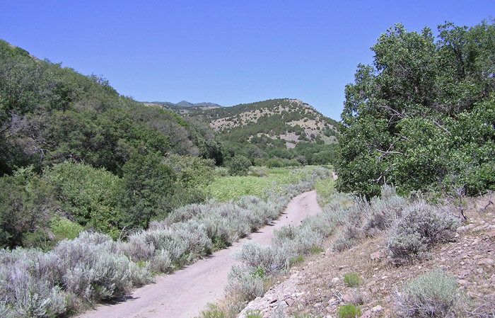 |
| The dirt road at the beginning of the run. |
This is where I cut south across a little stream and head up the trail going south for about a mile. The trail will continue on, but I took the more worn trail to the right heading due west (1.5). It runs parallel to a fire road for a half mile (not always in sight), and then splits off up the right canyon (2.0). After just over a mile, the trail connects with the fire road that I previously split off from (2.7). Just across the road to the left the trail continues. A good way to know if your in the right place at this point is if you immediately start to see aspen trees popping up out of nowhere. The trail winds up the mountain in a series of switchbacks.
 |
| There are lots of horses and bikers all over the place. |
I soon escape the tree cover onto an exposed section of the trail. There's no foliage at this point just a few cactus's and a bunch of rocks. Heading towards the ridge, I crossed through a small stand of trees. At the ridge, the trail approaches a road heading up the spine, the trail crosses it, and continues down the other side (3.3). Immediately the trail descends down onto the fire road, I head straight (left-ish) and follow the road around another small ridge, and then descend down into Yellow Fork Canyon. Follow the road down to the end of the canyon and then take the trail on the right (3.6). This is a nice single track trail with lots of soft loose dirt, making a great time for cruising down at fast speeds.
 |
| The trail coming down is a nice single track. |
The trail then just flows down the canyon for about a half mile or so (4.7). It then crosses a small creek and meets up with a small atv trail. At this point you can either continue to follow the little road, or you can explore the maze of bike trails that weave back and forth around the road. Don't worry about going down the wrong path at this point, everything leads back down to the parking lot. On the way down there are random hitching posts, benches, pick nick tables and a gate at one point. All to soon the road becomes familiar again and meets back up with the road that originally forked off by the pick nick tables (6.0).

No comments:
Post a Comment